
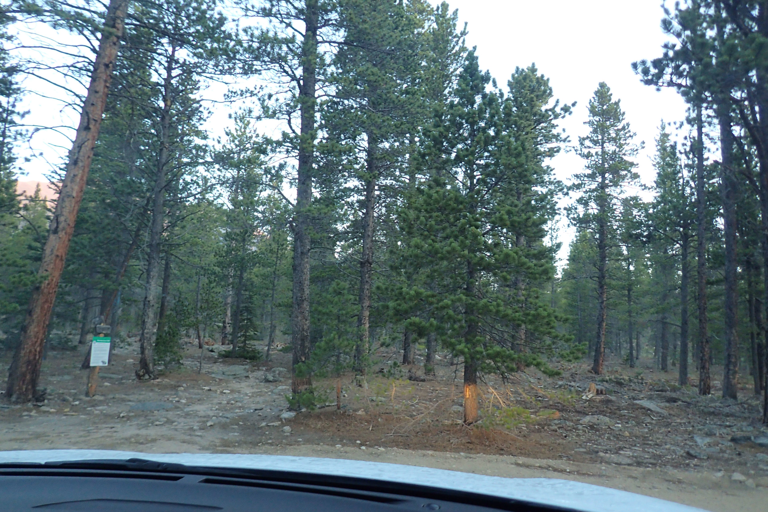
Horse Creek Trailhead at 5:45 a.m.
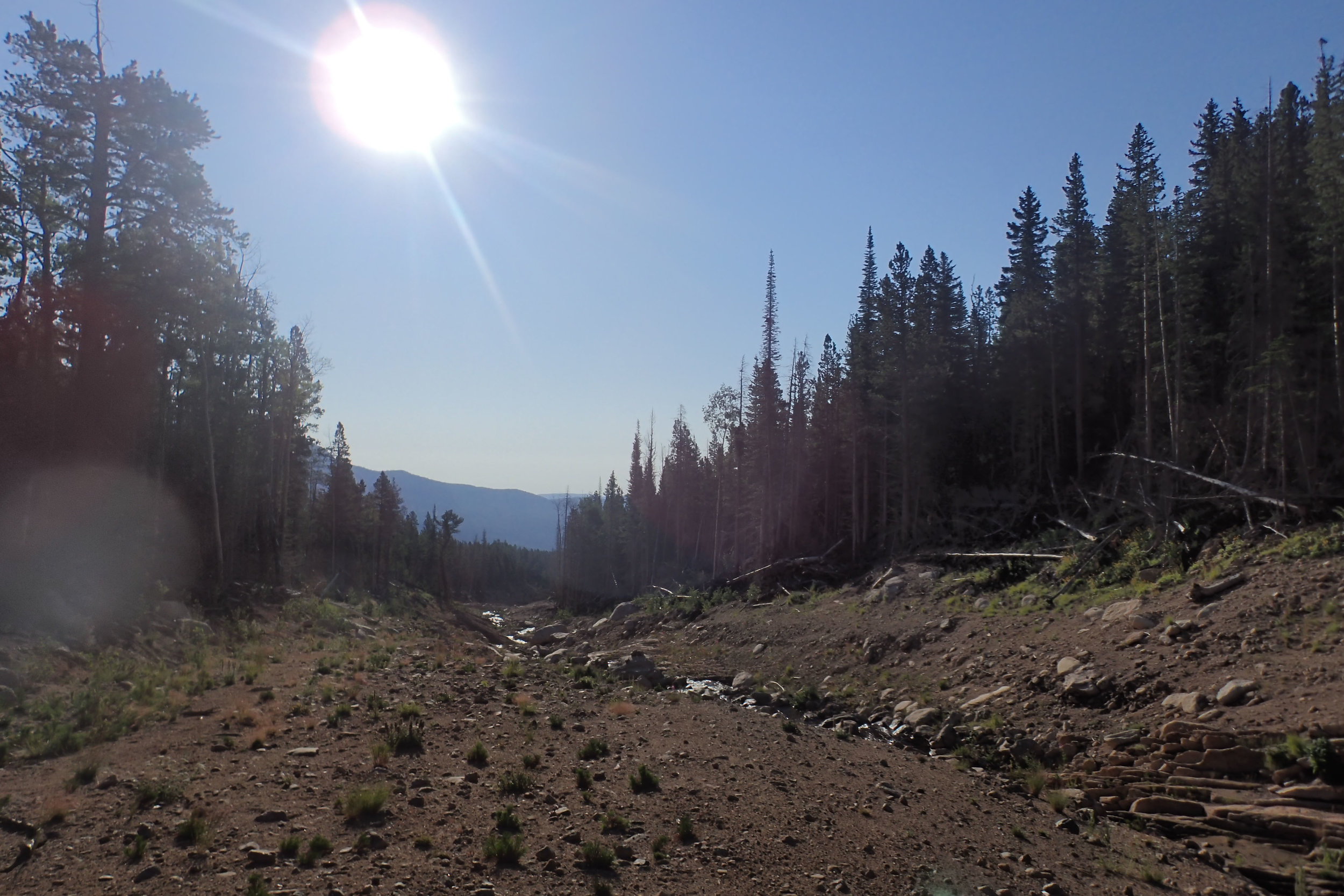
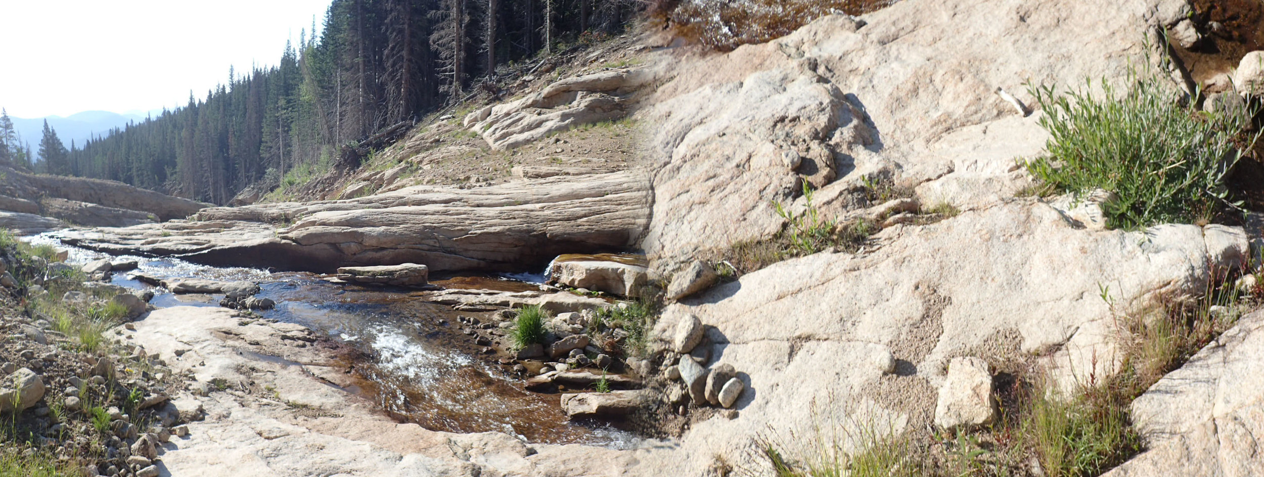
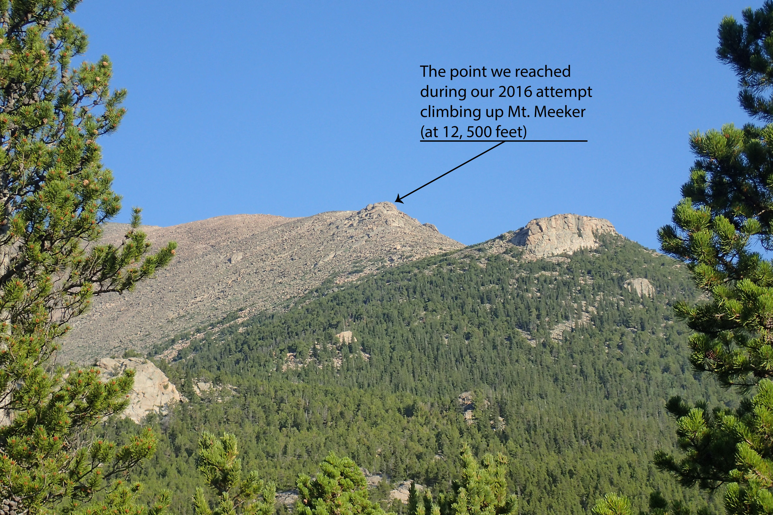
On Friday, July 6, 2018, at 5:45 AM, my husband (Dave) and I set out to climb Mt. Meeker. The climber’s trail that he used to take up Mt. Meeker (he summitted Mt. Meeker twice in the past solo) had been wiped out by the catastrophic 2013 Colorado Front Range flood, so we knew we would be making our own trail (just like we did during our 2016 attempt). The flood gouged the earth and left in its wake a deep and wide ravine. Horse Creek, which was originally level with the ground, now runs through the ravine.
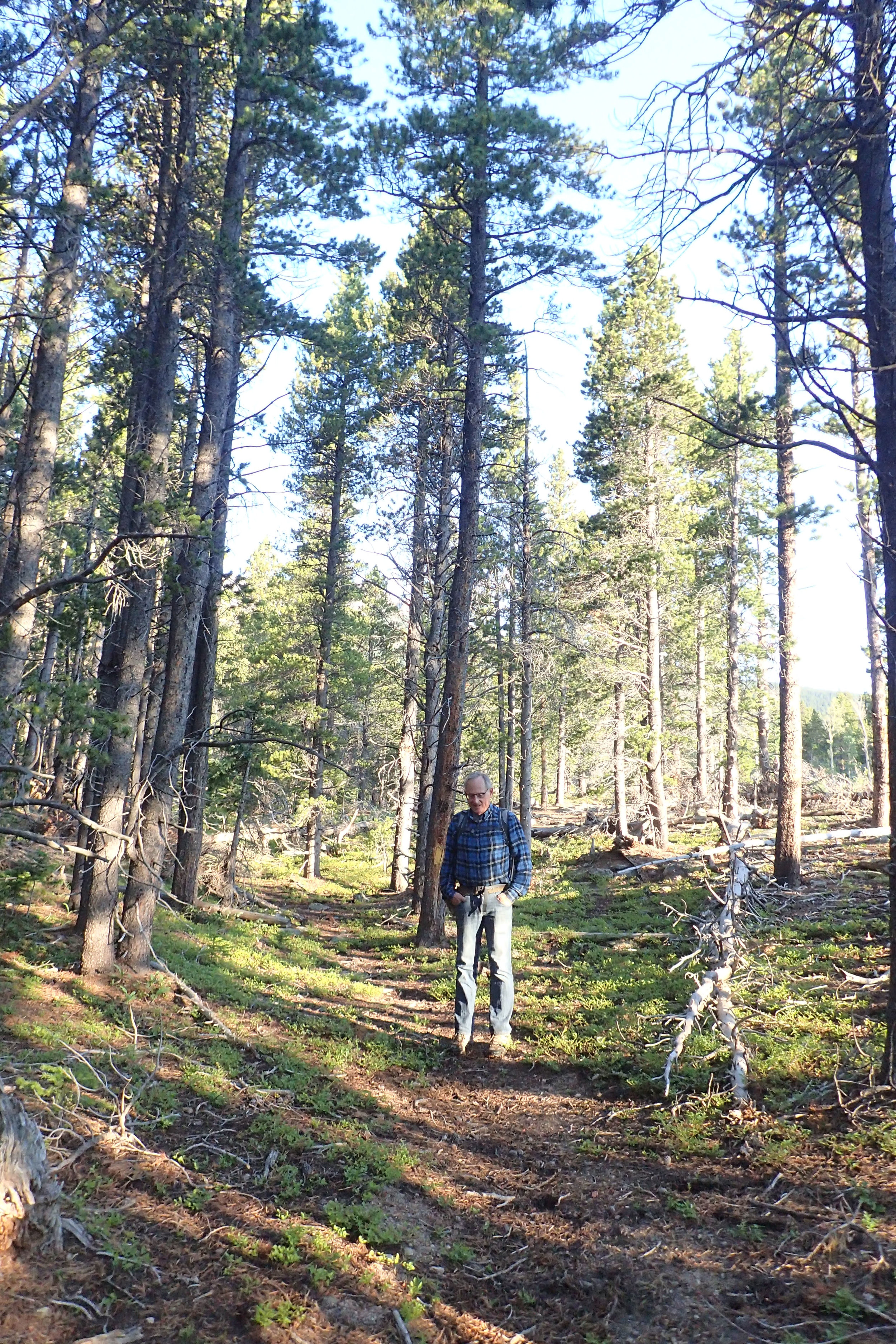
Dave had studied/printed topo maps of the area and outlined what he guessed to be the best route (so we won’t end up way off track like we did in 2016). We started on Horse Creek Trail and deviated from it as we found what looked to be a very old trail. The trail looked to be heading in the direction we outlined on the topo map. We lost the trail at some stretches and had to bushwhack until we found the trail again. We found marked trees and cairns along the way and were so excited to have found the old trail. That was until the trail ran out and ended at the ravine.


Down in the ravine
Our plans did not include crossing the ravine at all (we did not want a repeat of our 2016 attempt). But it seemed there was no other way, as going the other direction would have put us off track. So down the ravine we went. Going down was very treacherous; the ravine was not only steep, it was also covered in sand and loose rocks! Once down on the ravine, we had to crisscross the creek. The flood had deposited so much debris (huge boulders, logs, tree trunks) that some parts became impassable. We had to hop on slippery rocks littering the creek to crisscross a few times, and Dave almost slipped (while telling me to be careful because it looked like the rocks were slippery, smh).

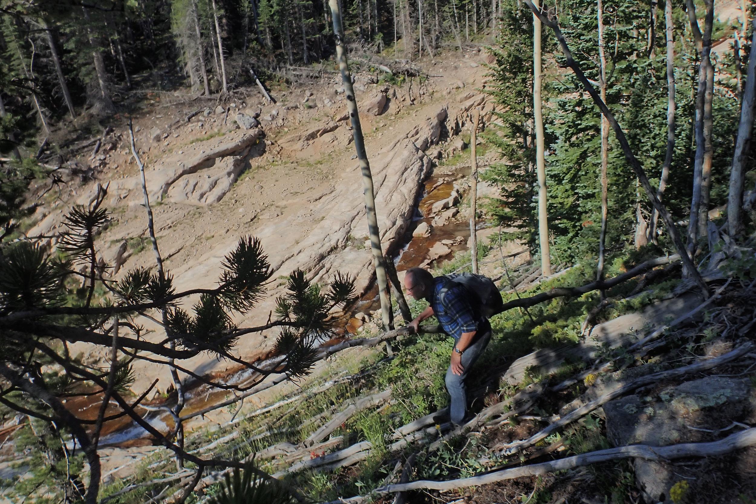


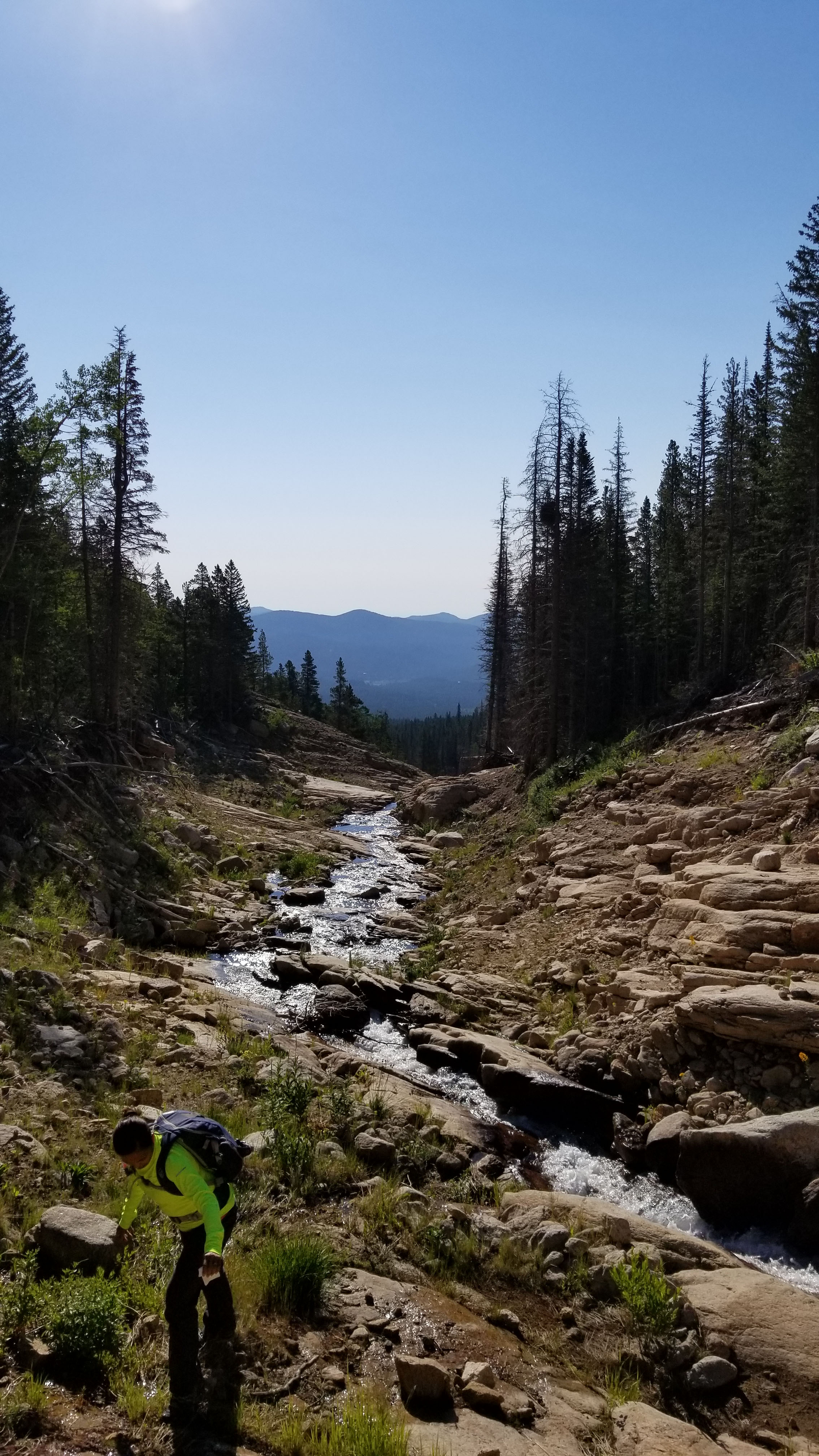
Off the ravine and back in the thick of the trees; path starting to get rocky.
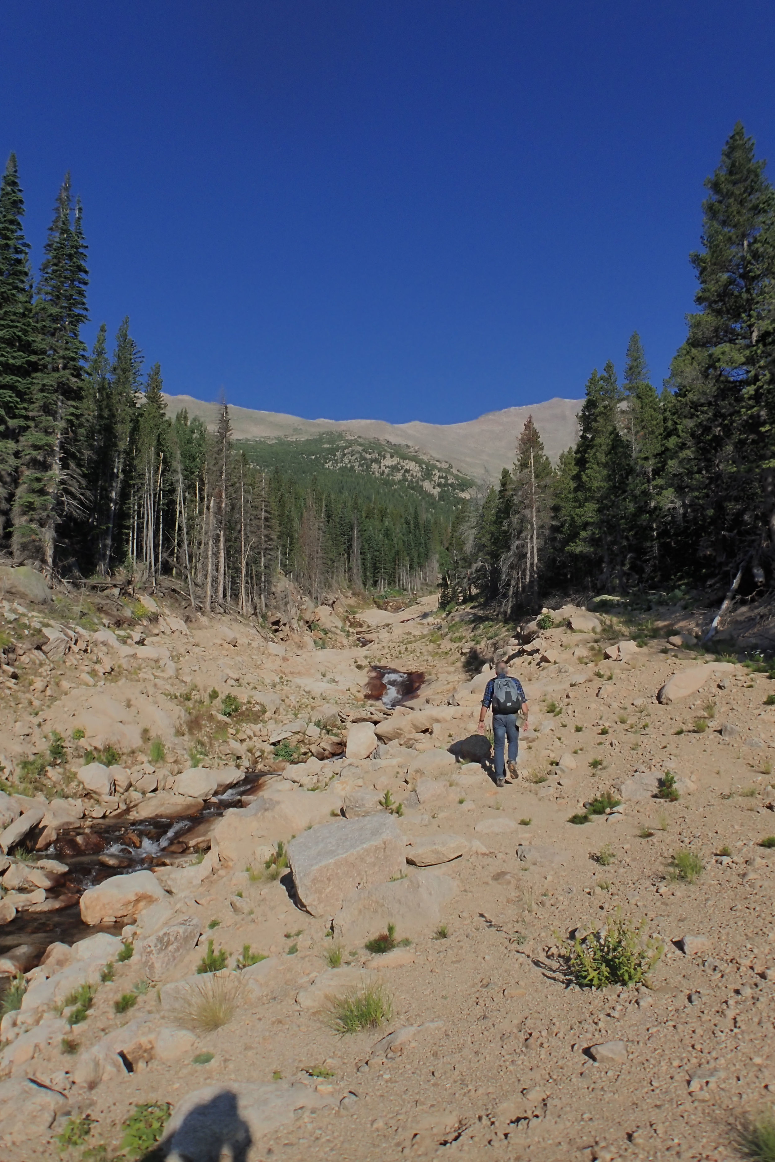
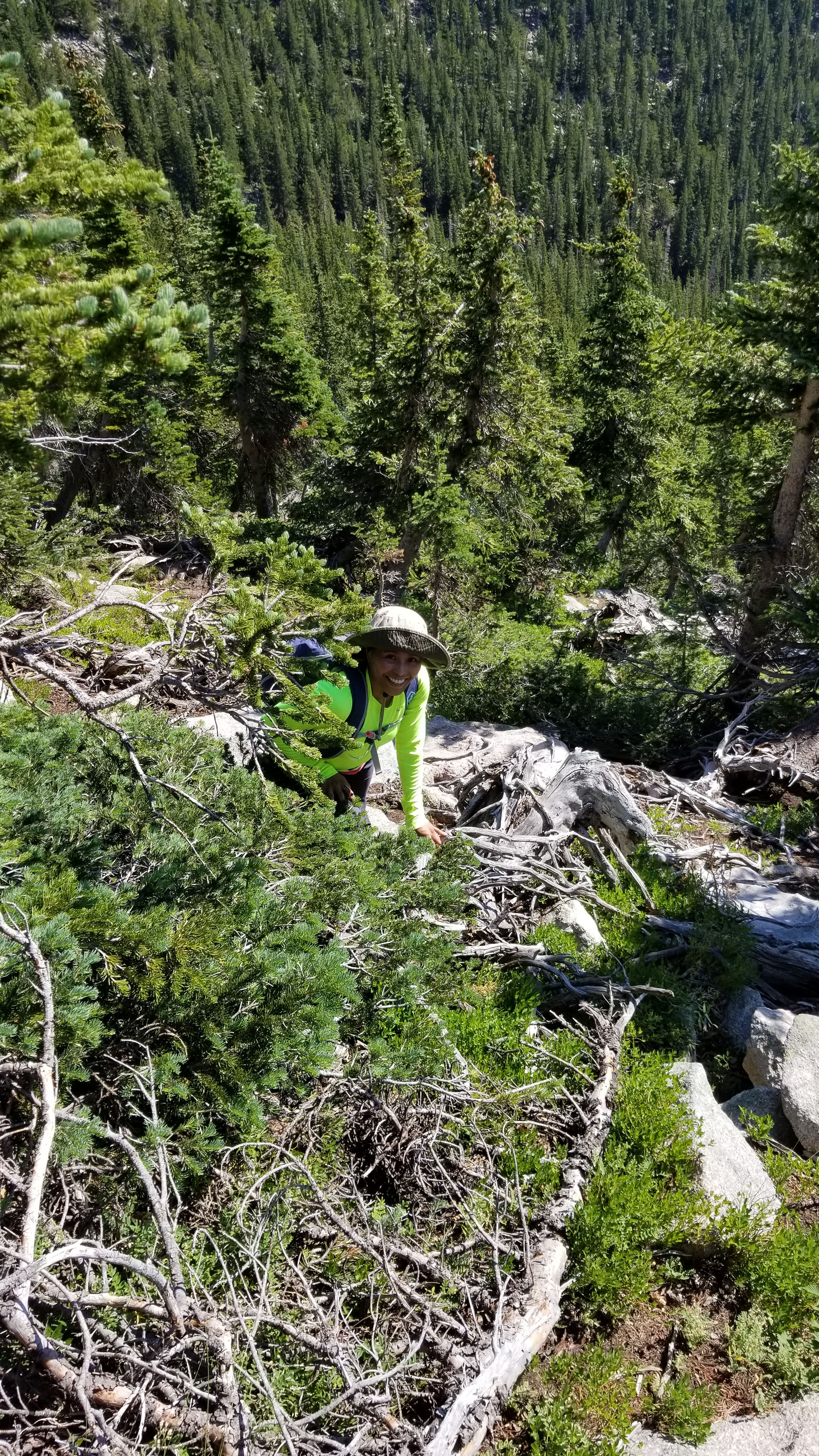
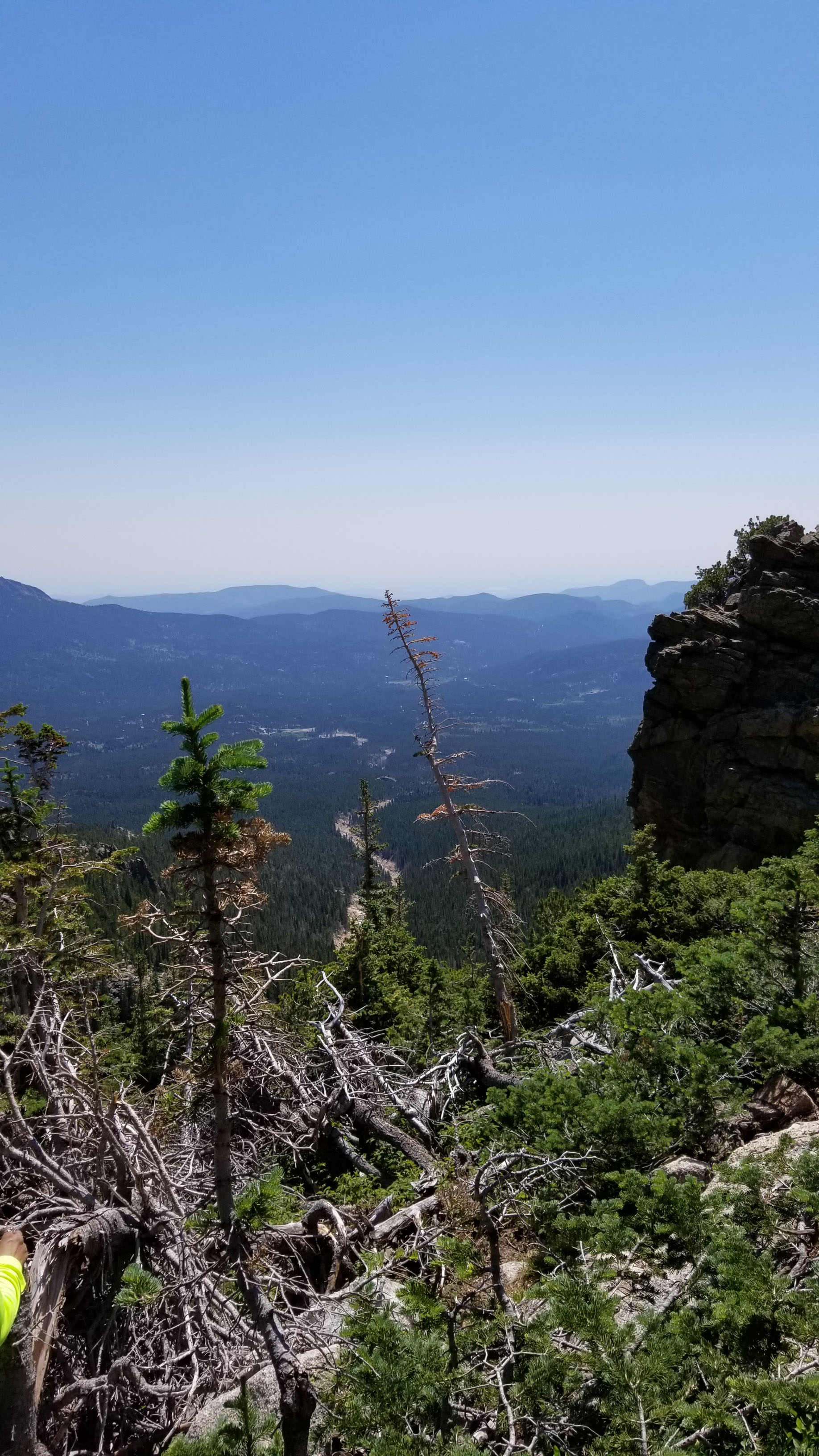
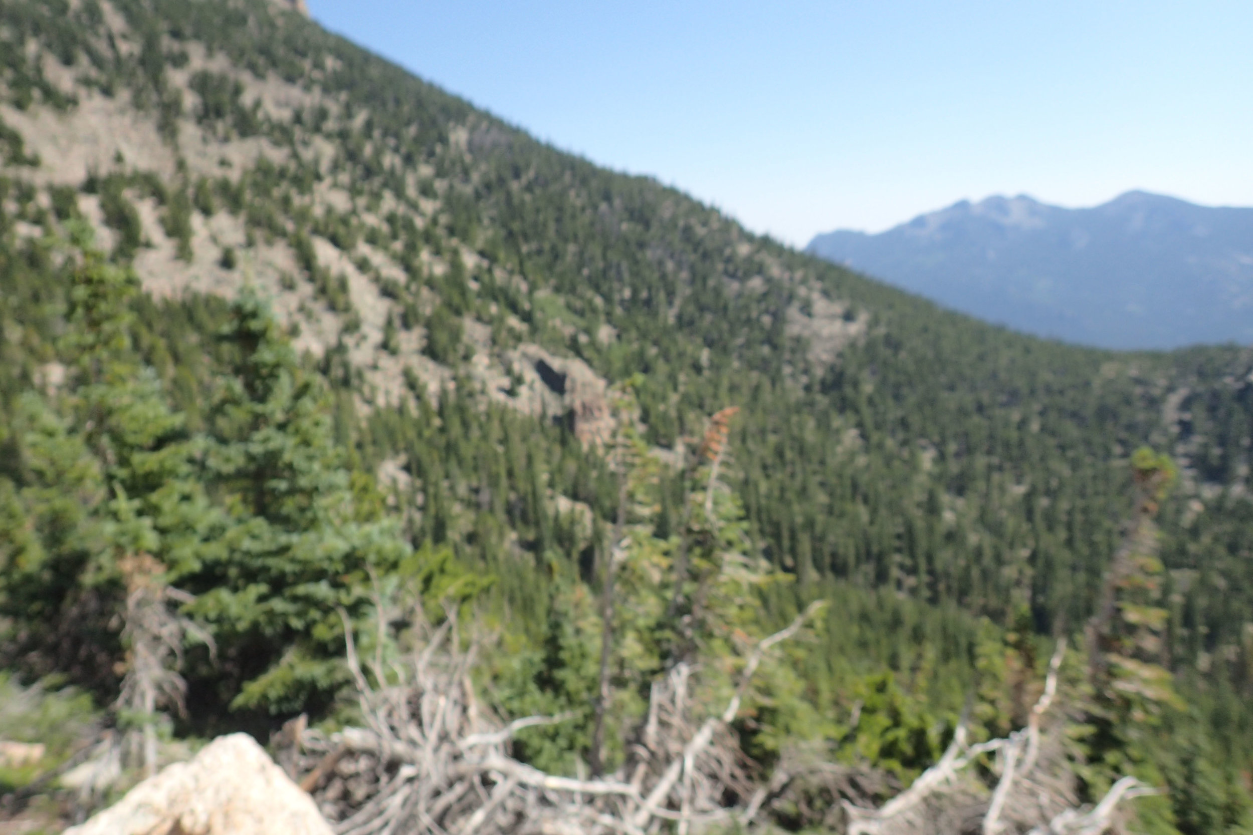
We continued on under the hot sun toward Mt. Meeker to gain more elevation. We could see the ravine narrowing up ahead and feared that it would eventually become impassable, and we won’t be able to go any further while on it. I was quick to suggest we get out of the ravine and back up to ground level while we were at a point in the ravine that was not as steep. So we clambered up the ravine and into the trees again (it was crazy!). From there we pretty much bushwhacked because there was no trail at all, but I was happy to be out of the ravine.
I was okay just bushwhacking but when the path we were taking started becoming just all rocks, and boulders as huge as trucks, I started getting nervous. I literally was on all fours climbing up because I didn’t trust myself to be climbing up those rocks standing up. Dave on the other hand was in his element and looked so at home hoping from rock to rock. He left me in the dust!
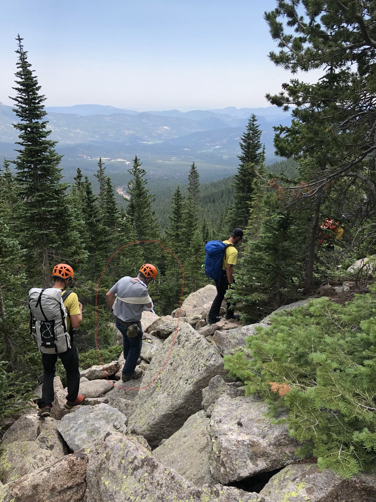
When we got to 10,700 feet, that’s when it happened. I saw Dave standing on top of a cluster of boulders craning his neck trying to figure out which way to go—left or right. I remember clearly looking up to him while climbing up own my cluster of rocks. I heard a grunt and when I looked up, I saw him on his right side on top of the rocks. I scrambled up to him and he said, “I think my wrist is broken; I can’t move it.” OMG! His wrist started swelling as big as his forearm! I was SO scared. We were up high on very nasty terrain and I just feared he wouldn’t be able to go safely down with only one good arm.
I immediately pulled out my cell phone and was so relieved to see two bars of signal. I dialed 911. It rang once when Dave said an ambulance would cost us a lot of money, so I immediately hang up (smh) and I said, “But what do we do?”
Then my phone rang and it was (Loveland) 911 calling back. We explained our situation and Loveland transferred us to Estes Park (Meeker is twenty minutes from Estes Park), who then connected us with the National Park Service.
Ethan with the Park Service asked for our location and Dave explained as best he could, describing land marks such as rock outcrops and our location in relation to the ravine (we could see the ravine straight down snaking its way through the trees). I could just imagine Ethan not even picturing where we were at all! I just couldn’t see how anyone could find anything in that terrain. Then I remembered that my waterproof and shockproof Olympus TG-3 camera (which I decided to bring—instead of my regular pocket camera—because it could take a beating) had built-in GPS in it! I asked Ethan if GPS coordinates would help and he said yes! That was the first time I actually turned on the GPS feature on the TG-3, and the camera was asking me to connect it to a computer to update the GPS (oops!). I ignored the warning and took a photo to get the GPS coordinates of our location and gave them to Ethan. Then Ethan said that three park rangers were actually in our vicinity looking for a missing person (who climbed Mt. Meeker on June 30) and that he could radio them to look for us. HUGE SIGH OF RELIEF!
Ethan said he would like for us to stay where we were because the park rangers were above us. He also asked if it was possible for us to get up a little higher. Dave told him we could move up higher to the rock outcrop to our right. I immediately said, no, we are not moving! Ethan said to wait 10 to 15 minutes for the rangers to arrive and to keep my phone close in case they call and he hung up. So we waited…
While waiting I told Dave not to move because I was afraid for him to move while in so much pain. We didn’t have a first-aid kit. I only had my usual pillbox full of ibuprofen and allergy pills. I made him take four tablets of ibuprofen, which at first he refused because it would not do anything. Then I offered my long-sleeved shirt to use as a sling, and he said he didn’t want to get blood all over it (what is the abbreviation for eyes rolling; you know, like LOL?) He did have his plaid long-sleeved shirt which I fashioned into a sling as best I could.
The accident happened around 10:00 a.m. My call to 911 was time stamped 10:06 a.m. After we got done talking with the Park Service, it was about 10:45 a.m. Then 11:00 a.m. rolled by, then 11:15, and we started getting really worried (and of course I lost my cell signal!). Dave said he’d rather be moving so we won’t get caught in the weather (chance of thunderstorm later that afternoon). So I said okay, let’s just go (but fearing at the thought of him going down with only one good arm). He said we wait just until 11:30, and if no one came then we start heading back down. By 11:25 a.m. we heard someone calling out, and just like in the movies where people waiting for rescue get really excited when rescue arrives, Dave and I yelled in unison, “Over here….”
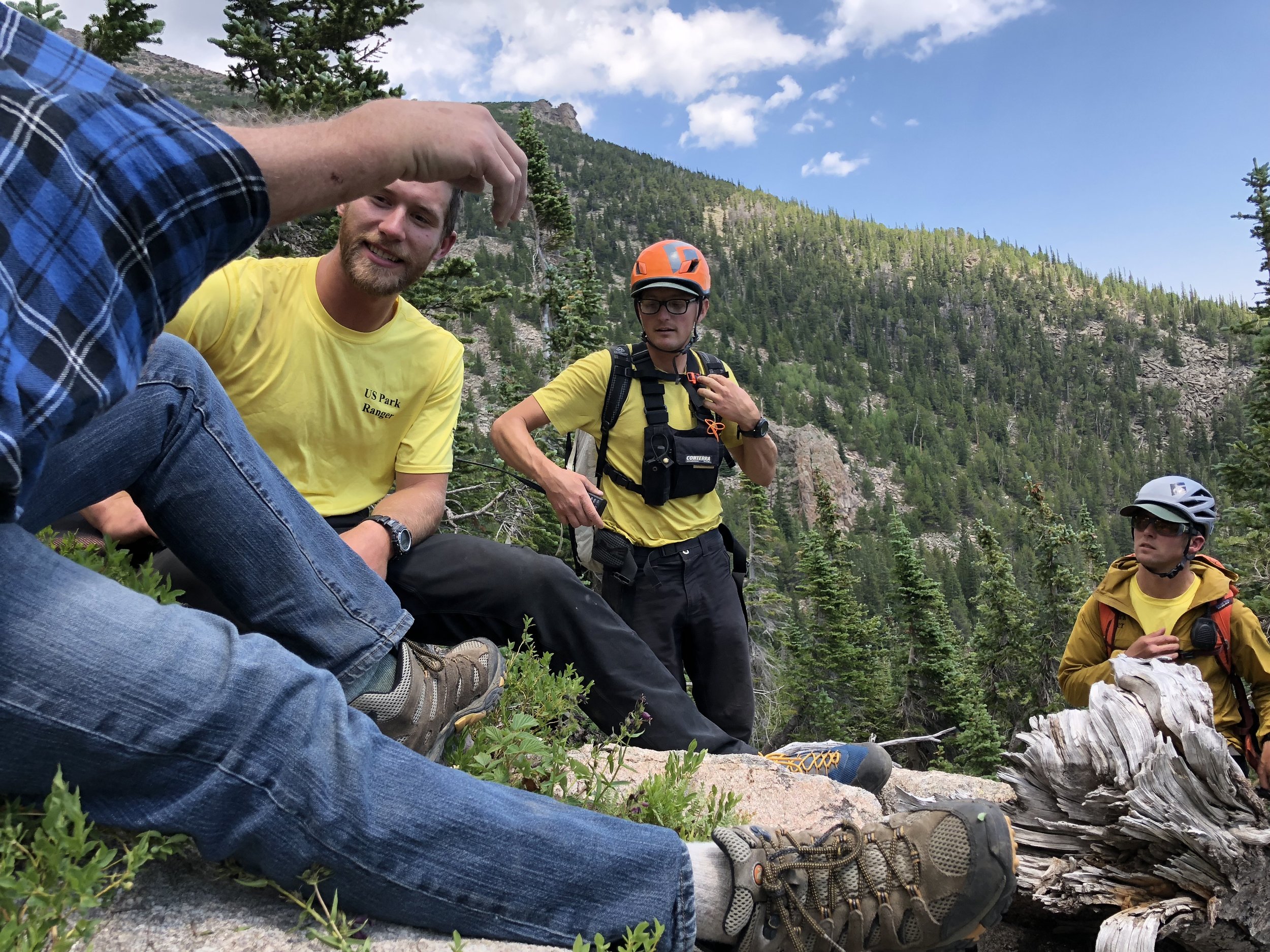
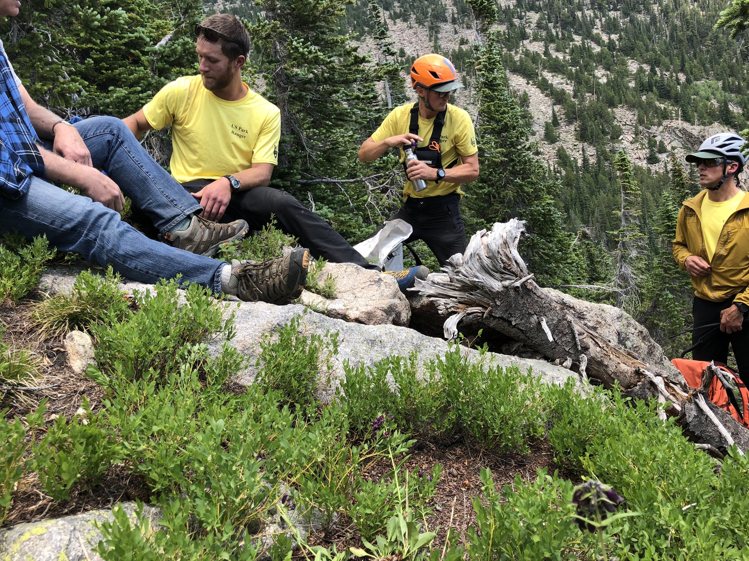
Then, nothing… The voice sounded like it was way below us and really far away. Dave and I started going down (with me constantly telling him to go down on his butt!) to meet whoever it was who called out. There was nothing for a while and we kept calling out and going down. Then we heard the voice more frequently and Dave and I got even more excited. We didn’t have to go down far, thankfully, before I saw a human wearing a yellow shirt, and a second one. The park rangers have arrived; imagine our relief! There were three of them (Danny, Adam, and Phil) looking for us in different directions. Adam had to call out to Phil to come to our location.
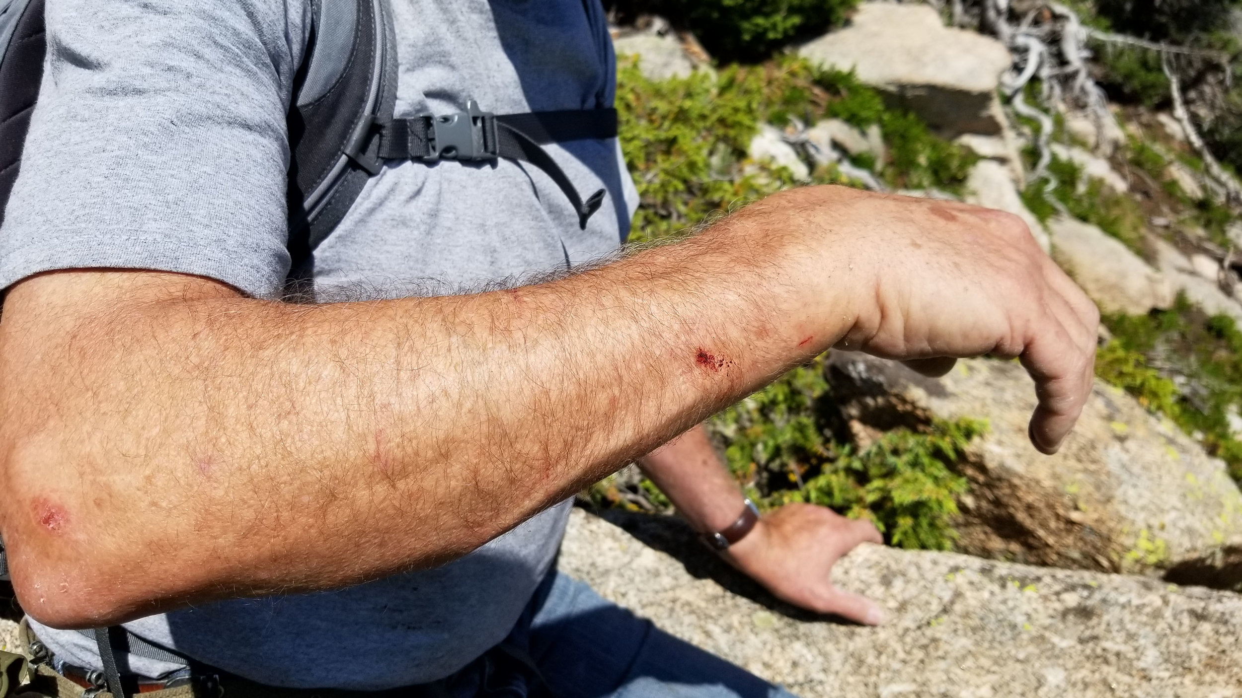
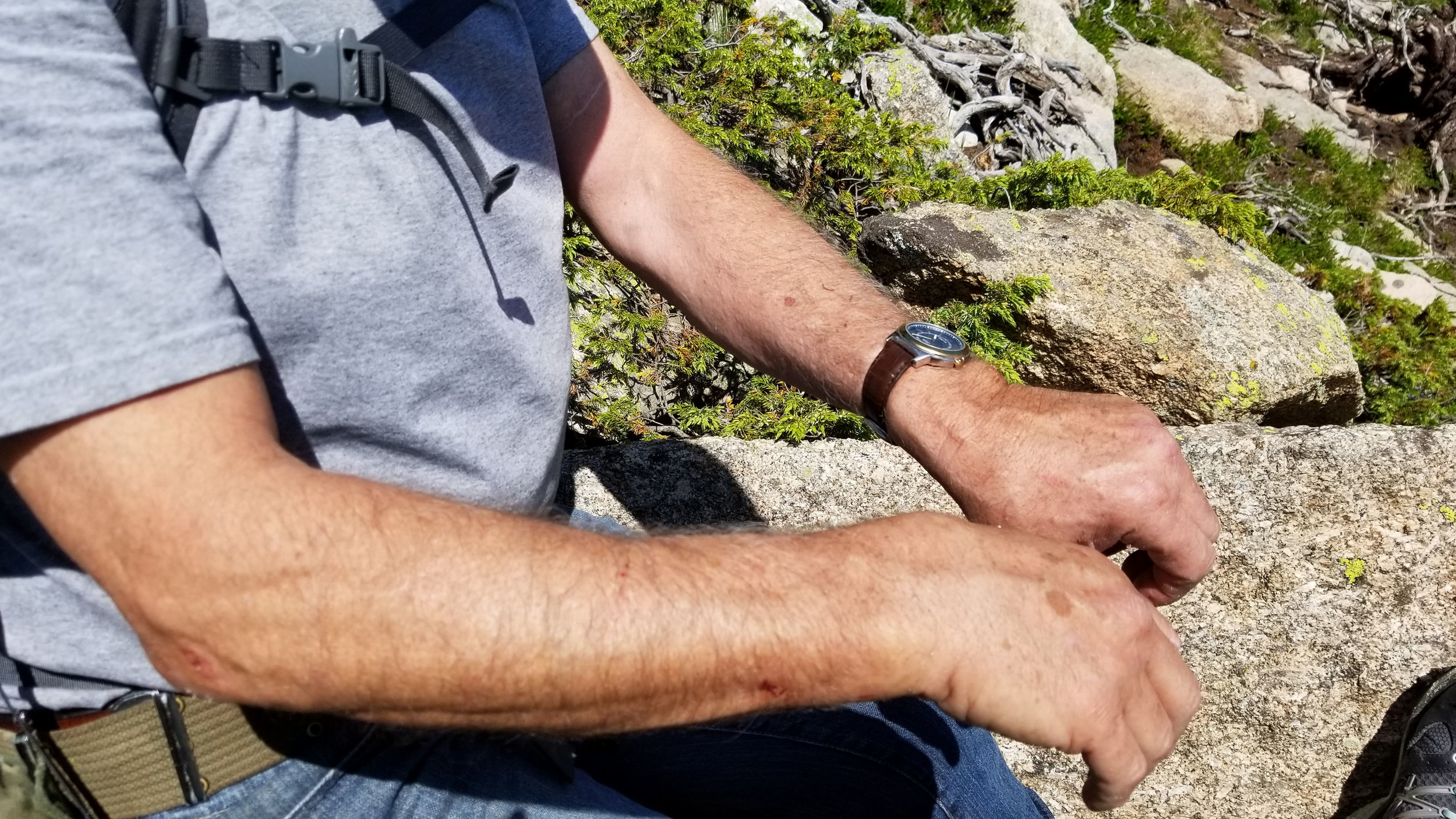
All three park rangers were medics thankfully and, among their supplies, Phil was able to patch Dave up as best he could, complete with a SAM Splint. They gave Dave a once over and took his vitals. They were concerned about other injuries because it was a fall. The fall thankfully did not happen while Dave was walking, nor he fell and rolled down the mountain! He had an ugly scrape on his forearm, however.
While Dave was being fixed up we got to talking about the man who climbed Mt. Meeker on June 30 but never got back down (a press release had been broadcast so it wasn’t confidential anymore at that point). He had taken a selfie on the summit of Mt. Meeker and texted it to a friend, and that was the last time they heard of him. People have been searching for him for five days! (While Dave and I were hiking up, we saw a helicopter circling around and Dave surmised they must have been looking for someone. The helicopter was still there when the accident happened and I frantically waved at it to get the pilot’s attention. But they were on the other side of Meeker and was not looking in our direction for sure.)
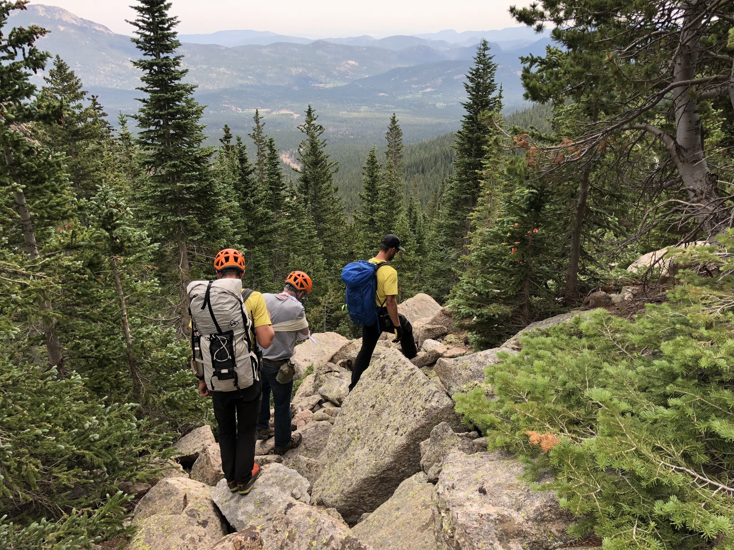
It was around 12:00 p.m. when the park rangers finally said we could start heading back down. And I had to ask if they were going with us (fearing they would say no). Thankfully, they were!! Our goal was to find Horse Creek Trail and take the trail back to our car. Phil took the lead to scout for the most manageable way to descend. Danny and Adam sandwiched Dave as spotters to catch him if he fell. I couldn’t even begin to describe how scared I was for Dave. We had to climb down and climb up some huge boulders and step over fallen logs and go through thick vegetation (it was crazy!).

Crossing a small creek. Bushes laying sideways became very slick from the rain.
Then it started raining and it made everything slick. We pretty much ignored the rain, especially me. I didn’t care if I got soaked; I just wanted to get off the rocks! Dave fell three times; once on his injured side, and I felt for him. We came to a relatively small creek we had to cross. As Dave was crossing the creek, I saw him just fall (on his backside at least) and he had so much trouble getting back up even with the two park rangers assisting him (everything was so slick, and with only arm, it was very hard to balance). When it was my turn to cross the creek, I almost slipped myself!
After about two hours of walking on and climbing down rocks, we finally came to level ground, and I was SO happy to see dirt! I didn’t care if we had to bushwhack (which we did); I just didn’t want to deal with the rocks anymore. Then thirty minutes later, Danny announced, “Found the (Horse Creek) trail!” I had never been so relieved in my life!
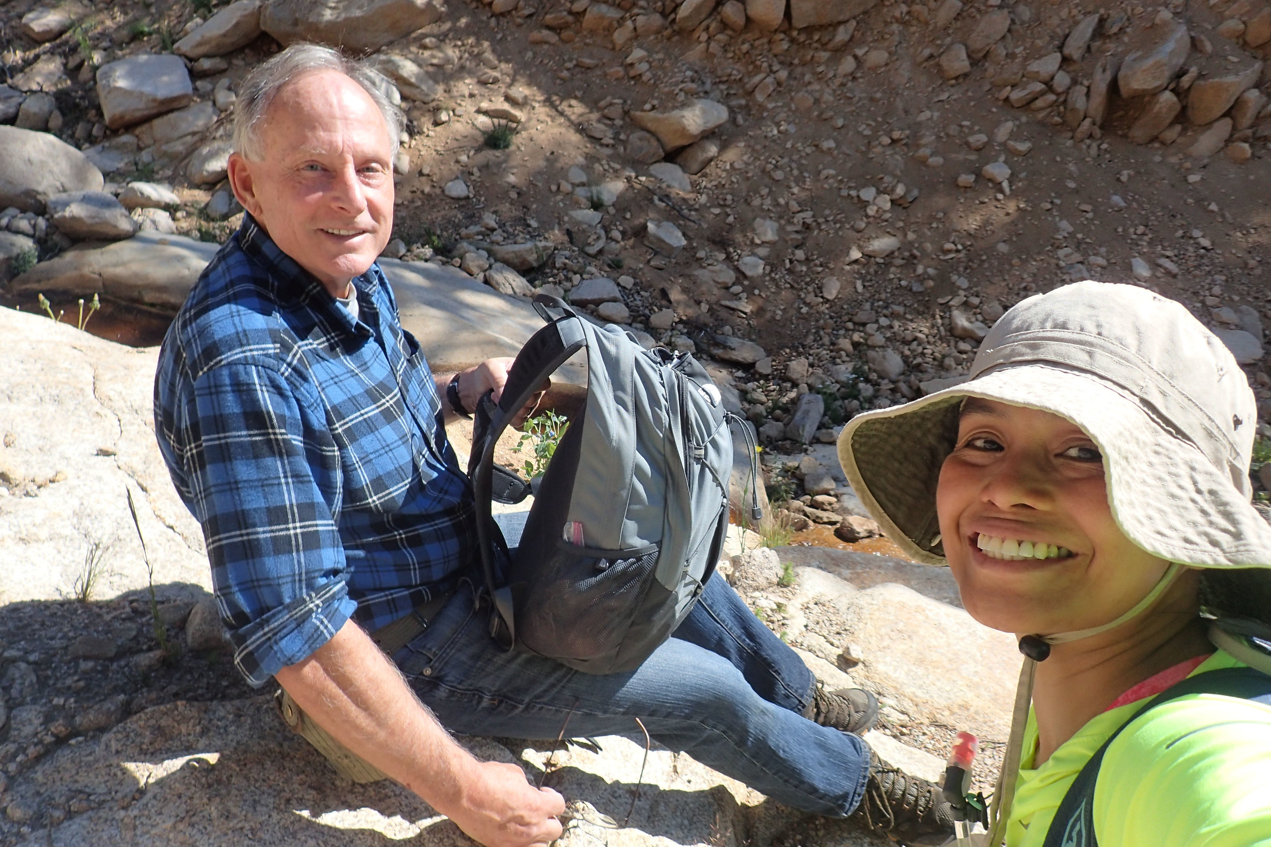
The stress lifted off a little once we were on the trail. It took us another hour to finally arrive at our car. Adam had radioed their headquarters ahead asking for someone to meet them at the trailhead to give them a lift. A park police (Mitch Shaffer) was waiting for them at the trailhead. We said our goodbyes, and I had to hug the guys. Saying we were so grateful they were there to rescue us is an understatement!
So Dave and I got in his car and because he could not drive, I had to. And for those of you who do not know, I do not drive everywhere. I do not drive on the highway, I have never driven to and from the mountains, I only drive around our little town. I do not even drive to Boulder and get nervous when I had to drive on US 36! I know…
Anyhow, Dave and I had to figure out where the Estes Park emergency hospital is, and because there was no cell signal whatsoever around Meeker Park, we had to go back to our rented cabin (which thankfully was just next door to the trailhead; the main reason why we chose to stay at that cabin) to get on the Wi-Fi.
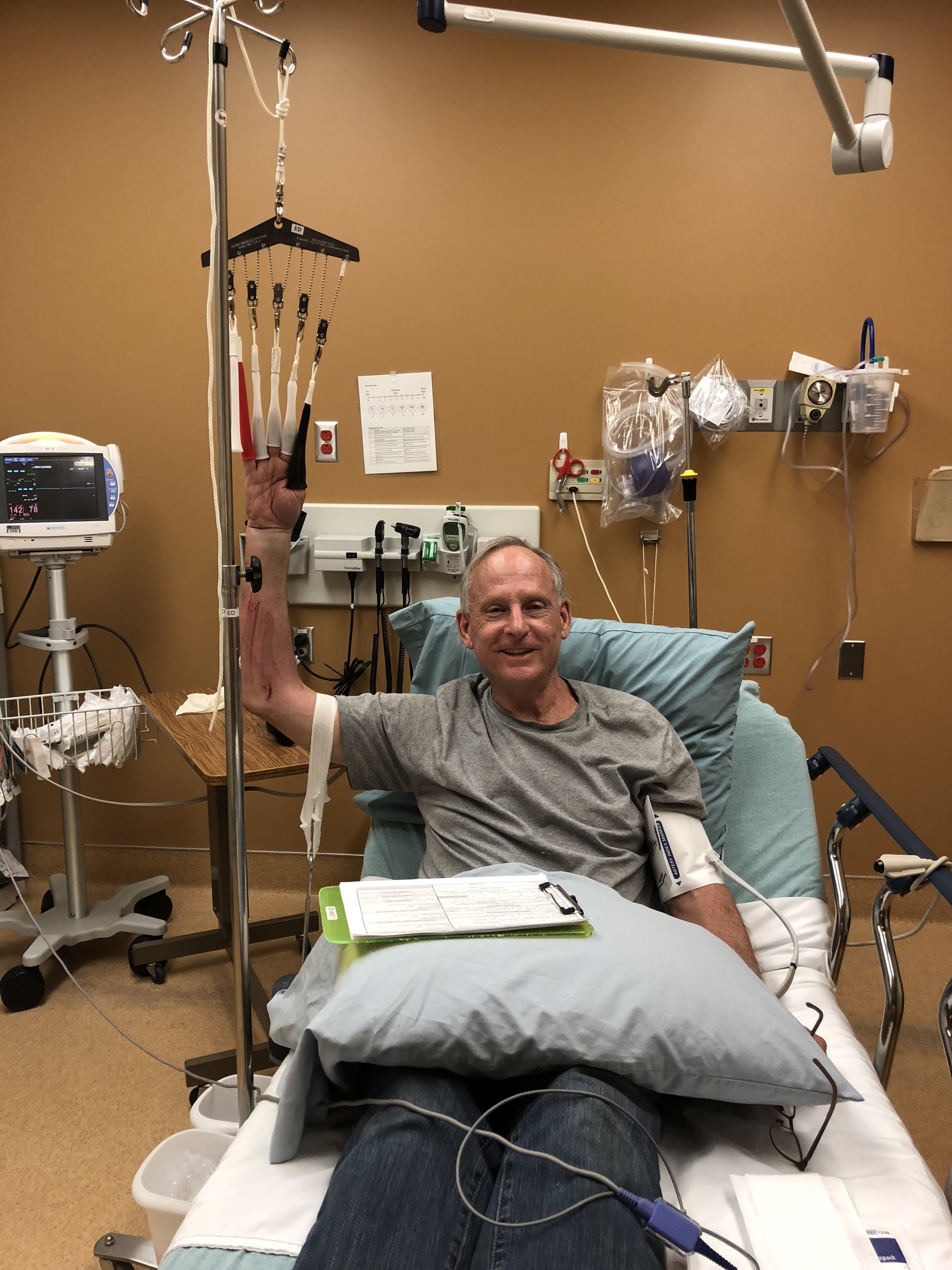
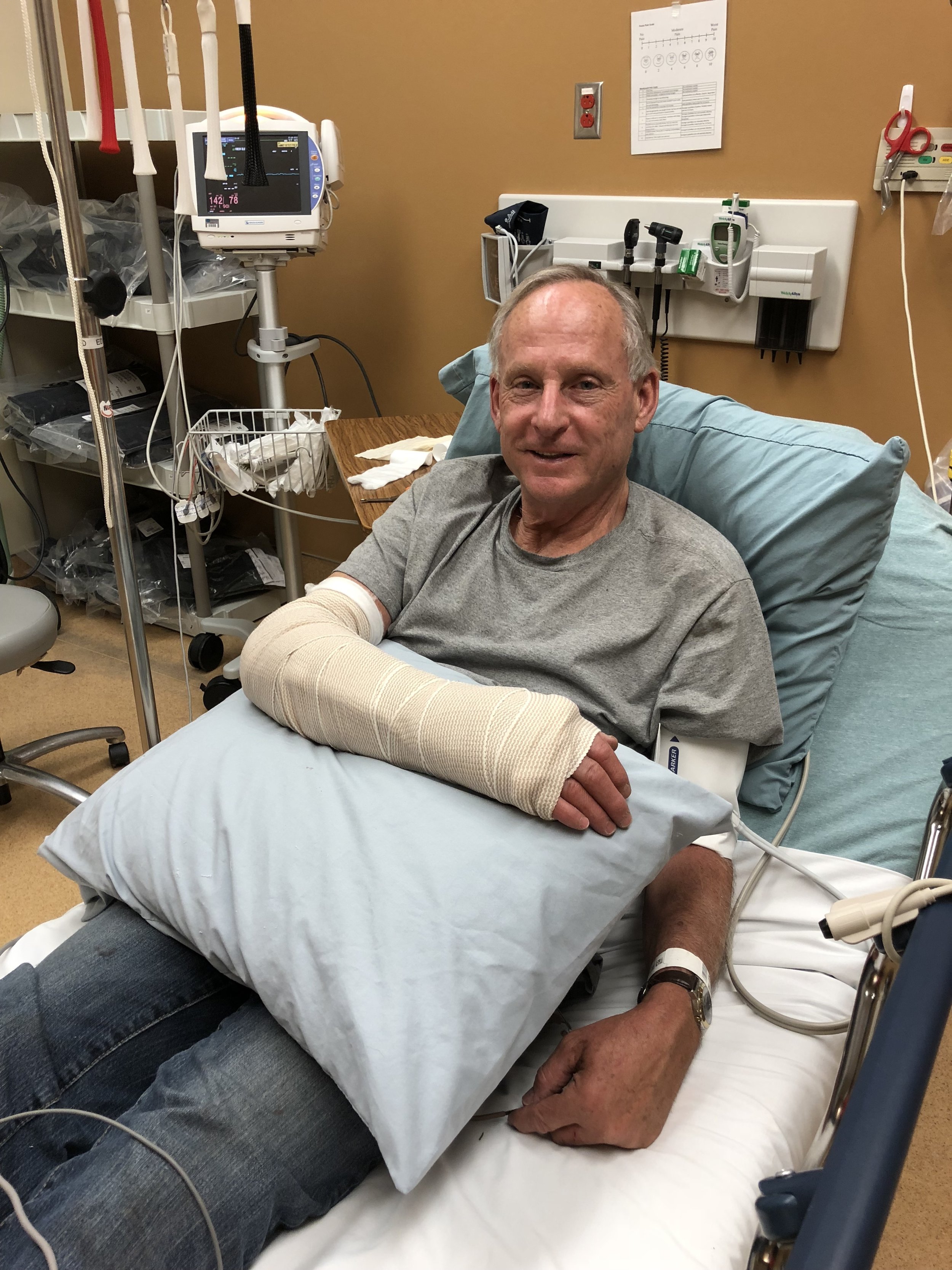
We arrived at Estes Park Medical Center (and yes, I drove!) around 4:15 p.m. Luckily, business was kind of slow when we got there so Dave got seen right away. The doctor fixed him up and we got out of there a little after 6:30 p.m. From the hospital we drove directly to the Rocky Mountain Pharmacy in town for some Vicodin. And to get food! Although Dave and I filled our backpacks with food for our hike, with everything that was going on, food was the last thing on our minds. There were no more open restaurants in the little strip mall where the pharmacy was, but there was a Safeway. So Safeway deli food it was for dinner that night.
When we got back to the cabin for the night, we were just EXHAUSTED!
The next day (Saturday, July 7, 2018) was check out day. We packed, collected the trash, loaded the car (with Dave helping as best he could, one handed) and, you guessed it, I drove on Highway 7 through the St. Vrain Canyon (with its twists and turns making me so nervous), then onto Highway 66 to Highway 287 all the way back to Broomfield!